

Mountain Bay Trail
- Difficulty
- Easy
- Distance
- 85.2 ml
- Ascent
- 851 ft
- Descent
- 1487 ft
Mesker Street, Weston, WI
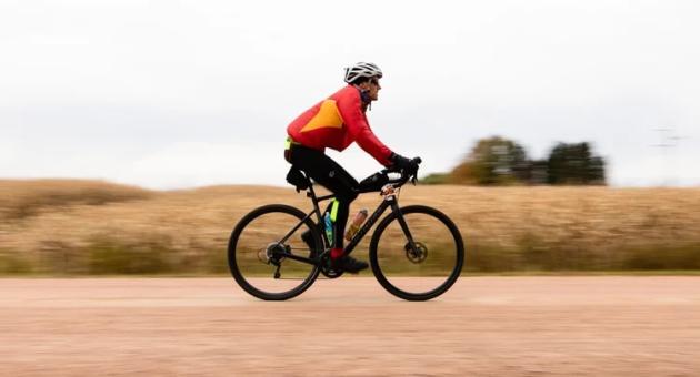
Immerse yourself in a mostly wooded journey through Marathon, Shawano, and Brown counties. Thanks to its origin as an abandoned railroad grade, the trail offers a pancake-flat, gravel-clay surface—perfect for riders of all abilities. Rated “Easy,” it’s an inviting adventure for everyone. Along the way, you’ll find plenty of parking and frequently placed restrooms, ensuring a comfortable experience throughout your ride.
Kick off your journey at the western trailhead in Weston, located at 5201 Mesker St. Here, you’ll appreciate ample parking, convenient restrooms, fresh water, and a Fixation Station so you can start your adventure with peace of mind. As you ride southeast for about 9 miles, you’ll pass through the Ringle Mountain Bike Park, equipped with water, restrooms, and another Fixation Station in the parking lot. The path then leads you to the charming village of Hatley, where the Mountain-Bay State Trail merges with the renowned Ice Age Trail for a picturesque 2-mile stretch. Seven miles farther brings you to Eland, where the trail briefly shares its course with the Wiouwash State Trail for about 0.7 miles—just remember to stay left to continue east on the Mountain-Bay State Trail.
Along the way, you’ll cross numerous bridges—keep an eye out, as they can be slippery when wet. About 12 miles from Eland, you’ll reach Bowler and one of the trail’s highlights: a stunning covered bridge over the North Branch Embarrass River. Pause here to admire the view and snap a dramatic photo from the riverbank below.
Continue your ride another 20 miles to the city of Shawano, where the trail briefly detours onto quiet roads before rejoining the dedicated path. Here, you’ll find a vibrant city atmosphere with local restaurants, shops, and even a former train depot—now a bicycle and outfitters shop. Don’t miss the chance to visit Twig’s Beverage for a refreshing soda and a fascinating museum tour.
Leaving Shawano behind, the trail meanders through peaceful woodlands and open farmland, guiding you to the Village of Pulaski. Here, Pulaski Community Park welcomes you with restrooms, parking, and nearby treats like ice cream and snacks to recharge your energy.
Twelve miles farther south, you’ll reach the trail’s southern end near Howard Memorial Park on Lake-view Drive. Just a short ride away, Howard offers a variety of restaurants and bars—perfect for a celebratory meal after your adventure. Simply head left on Glendale Avenue and right onto Riverview Drive to explore the local flavors.
Please note: Anyone age 16 or older who bikes, cross-country skis, horseback rides, or inline skates on the trail is required to have a state trail pass. Walking or hiking does not require a pass. You can conveniently purchase state trail passes online, at individual properties, DNR service centers, or from state trail pass vendors, making it easy to prepare for your journey.
Distance: 83 miles
Difficulty: Easy
Surface: Gravel-clay rail trail (former railroad grade)
Elevation Gain: Minimal
Trailhead: Weston
Parking: Available at multiple trailhead and parks along the route
Trail Highlights:
- Weston trailhead amenities (restrooms, water, Fixation Station)
- Ringle Mountain Bike Park access and services
- Ice Age Trail overlap near Hatley
- Covered bridge near Bowler over the Embarrass River
- Shawano dining, shops, and trail-friendly stops
- Pulaski Community Park rest area and nearby treat
- Southern endpoint near Howard with access to Green Bay area services